
 Favorable conditions are forecasted in the coming weeks to provide prescribed burning opportunities across the Idaho Panhandle National Forests. Multiple prescribed burning projects are planned this fall, although the exact day of ignitions will depend upon conditions aligning with safe implementation.
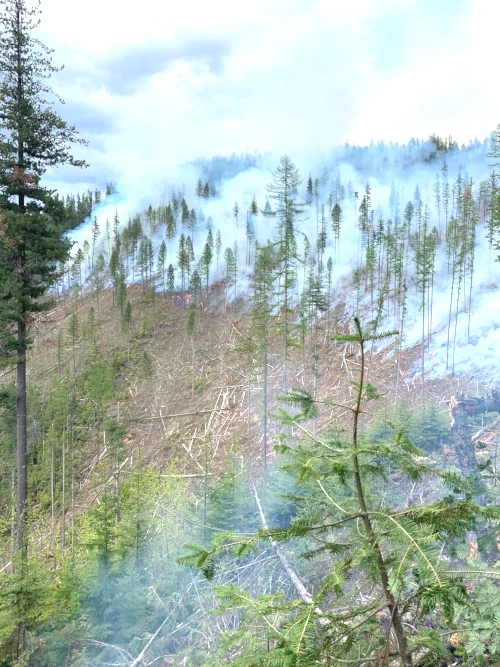
Prescribed burning is part of each Ranger District’s annual natural resource management program to reduce hazardous fuels, prepare areas for tree planting, and improve wildlife forage. The Lone Cabin project on the Coeur d’Alene River Ranger District will be the first ignitions for the season and could begin as soon as Wednesday, September 4.
Smoke will likely be visible from I-90 and US 95 in the Coeur d’Alene area. Fire managers are looking to seize a brief window before burn condition opportunities on shaded aspects are lost to fall rains. Nearby, timber harvest is wrapping up on the Ridge Creek Fire Salvage. Located between Hayden Creek and South Chilco Mountain, harvest operations have necessitated Monday – Friday road closures in the area that are estimated to be in place through October.
Other prescribed fire and fuel reduction projects will occur as prescriptive conditions are met. More information, such as project ignition status and maps, can be found on http://bit.ly/NorthIdahoRxFire.
Fire managers will evaluate weather and fuels to determine when burning can be safely conducted. Burned areas are monitored to ensure that fire remains within the project boundaries.
The Idaho Panhandle National Forests works with the Montana/Idaho Airshed Group and the Idaho Department of Environmental Quality (DEQ) to minimize smoke impacts from prescribed burning. All prescribed burning decisions are based on the Group’s recommendations, given predicted smoke emissions and dispersion forecasts. For additional information on air quality, smoke management, and forecasts, see https://mi.airshedgroup.org.
The public is urged to stay away from project areas during burning operations and for a few days afterward. Please be aware of additional hazards in burned areas, such as unstable soil, stump holes, and fire-weakened trees. Signs will be posted along access roads and near affected trailheads and trail junctions during operations. Temporary access restrictions or closures will be necessary for public safety. The exact timing and acreage of burns depend on fuel conditions and wind patterns, and we will be publishing updates as the season progresses.
Anyone seeking additional information is welcome to call the IPNF Fire Information Line, (208) 557-8813.